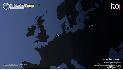
Airspace Rebooted from ItoWorld on Vimeo.
The animation is based on information collected by volunteers of the FlightRadar24 project who use VHF receivers to gather data from transmission from commercial planes. The base mapping is from OpenStreetMap.
On 17 April 2010 there were virtually no flights:
By 18 April 2010 there were a few more:
By 19 April 2010 there were more flights over mainland Europe but still none from United Kingdom airports:

From 20 April 2010 flights were pretty much back to normal (note that there is still no data for much of France and for some other parts of Europe).

As well as our original animation which we released using a creative commons share -alike license there is now a version set to music and one with an ash cloud overlay.
ITO World are experts at transport data presentation and Open Data. We have produced an animation for Sir Tim Berners Lee which he showed at TED of edits to OpenStreetMap during 2009 and our 'OSM 2008: A Year of Edits' animation has been viewed 145,000 times online and shown at numerous conferences.
ITO have also been documenting the creative ways people used social media to get home after the flight disruptions as part of Ideas in Transit.


1 comment:
we posted the video on our website: Geografica. The student organisation of the Universety of Ghent for students in Geography
Post a Comment