
OSM Mapper is a product (free to use after registration) that allows users to analyse and view data for areas of interest, but until now coverage has been limited to Europe. To find out more about the product's features, see the original announcement.
Here is an image showing nice team-work in Melbourne, Australia.

The following images show examples of recent activity around the world. Please note that currently only ITO staff can create such wide-area images.
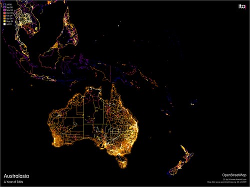
Zooming out from Melbourne we can see where there has been recent activity across Australasia.
Head north and see what been happening in Japan, parts of China and North and South Korea.

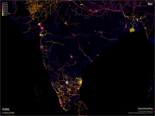
Moving west we can see what is going on in India. The big bulk upload of trunk roads arrived in February 2008, courtesy of Automotive Navigation Data. Since then there have been some busy areas, possibly due to the series of mapping parties held in India.
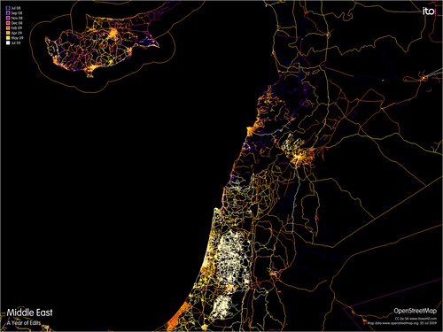
Moving further west we can see activity across Cyprus, Lebanon, Israel, Egypt and Palestine with a lot of progress in the past few months.
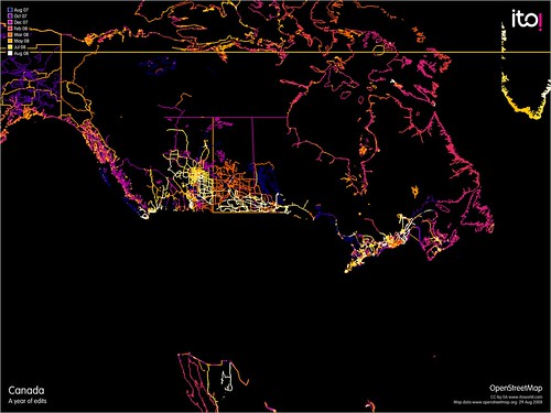
Skipping existing coverage in Europe, we can see Canada - with lots of activity in the more densely populated South.
Heading down to South America, we can see that clearly some areas are doing a lot of work.

Finally, if the place you are really interested in is the USA then subscribe to this blog and we will post here as soon as we are set up to handle all the TIGER data.
If you want to find out more about the product and how to subscribe or use it then read our original announcement.
We would like to thank Geofabrik for providing free access to their daily version of the OSM datafile.
This product was developed with support from Ideas in Transit, a five-year research project following user-led information technology innovation in the transport domain funded by the UK Department for Transport, the Technology Strategy Board and the Engineering and Physical Sciences Research Council.

