
Since the conference we have expanded the area available from the UK to the whole of Europe, and have moved from a weekly to a daily update. The next challenge is worldwide coverage which we will do as soon as we are confident with Europe. Btw, the new version of Potlatch that went live today means that it is now possible to click on the 'Potlatch' link from ITO Mapper and enter Potlatch with the relevant feature already selected.
Using this product you can set up one or more areas to monitor and analyse in a variety of ways. You can even establish RSS feeds to get alerts when other people make changes within areas of interest. You can also generate beautiful images to download and post anywhere as (CC-by-SA).
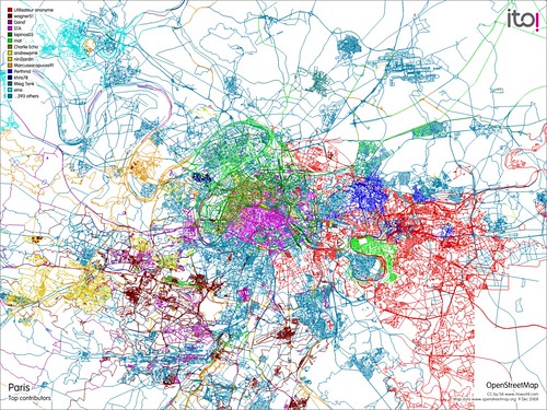
You can show the main contributors to the map using a view colour-coded by contributor. This image shows the top contributors in the Paris area.
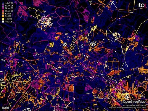
You can also see how long it has been since different parts of an area have been modified over various time frames. The next image shows changes in Berlin in the past month.
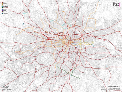
You can focus on a particular aspect of the data, eg railways, waterways, schools etc. This map shows the various railway systems in London.
You can subscribe to an RSS feed for recent changes to railways in London. As the feed contains GeoRSS data, you can also view the feed in an appropriate viewer like Google Maps.
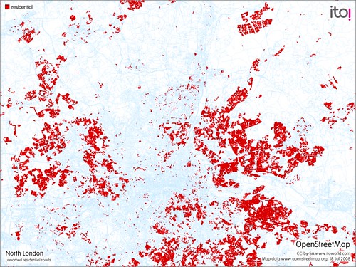
With filters, you can select features that are missing data. For example, this image shows a breakdown of unnamed residential roads in North London.
You can check for changes in an area by other people. This image below shows edits made in Ipswich by people other than PeterIto.

An RSS feed is also available to monitor the area above for changes by people other than PeterIto.
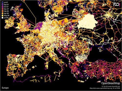
This image shows where we currently offer coverage (and also shows recent edits in the area).
Why not subscribe to our product, check out a tutorial slide presentation, or look at various images on Flickr?
There are a number of current limitations that will removed in due course: The coverage is Europe only. There is an size limit when selecting areas; this is large enough to cover most European cities - however the ability to generate images of very large areas, such as whole countries, is restricted due to the high processing times involved. Updates are normally daily and are unlikely to become more frequent just yet. It doesn't pay any attention to point features, only ways, so it is good for analysing roads and parks etc but not letter boxes and bicycle parks. We intend to offer functionality to allow people to share areas; you can do that now by sharing URLs, but we will implement a more formal approach in due course. Finally, deleted features are not picked up in the RSS feeds so you won't be warned if someone has deleted a feature, however big it is! Stay tuned to this blog for information about future enhancements.
Please give us feedback by commenting on this post, using the comment link at the bottom of each page in the product, or emailing support 'at' itoworld.com.

